

Your ads will be inserted here by
Easy Plugin for AdSense.
Please go to the plugin admin page to
Paste your ad code OR
Suppress this ad slot.
Driving 4WD from Cairns to the very ‘TIP’ of Australia through the Red Outback
With our petrol tank starting to get dangerously low after leaving Cooktown, our first stop on the isolated Cape York Peninsula was a remote roadhouse. We joined about a dozen 4WD trucks, trailers and vans of various brands, shapes and sizes all similarly covered with a coat of that ‘bloody’ red dust. Everybody who could had parked under the little available shade while others refilled their tanks with Cape York’s famously ‘high cost’ diesel. Some folks were eating their lunch on camp chairs by their vehicle; others sat at plastic tables and chairs provided by the roadside café.

All heads were raised as a new truck approached. We parked our 4WD Toyota Land Cruiser — our “Bushcamper” — by the petrol pump. Suddenly all eyes are staring at the two grey-haired ‘sheilas’. You could see them thinking something like:
“Not two 60-plus women on their own, driving a monster like that on these roads? There must be a bloke in there somewhere?”
After looking inside for the token male, there was much scratching of heads and muttering when he was nowhere to be see. Eventually it was too much for one man who approached us with a smile. “You two girls (I liked that) drive up here on your own?”.
This was how many conversations — and friendships — started during our trip across the vast outback from Cairns to the tip of the Australian Continent on the Cape York Peninsula.
Planning for the trip started two years ago during another 4WD outback challenge from Adelaide to Darwin which was a celebration of our respective 60th birthdays. The website I had previously used www.Exploreoz.com rated the difficulty for this trip as 4 1/2 stars – 5 stars being the ultimate challenge. We were much less daunted than were family and friends who kept asking well-intentioned questions. “Can you not join a ‘tag along’ group (where one travels in convoy)?” “Will you take a satellite phone?” “Can we have a detailed itinerary?” My son even parted with his precious iPhone so we could have GPS.
The first step was to get to know the area and start drafting an itinerary. So we downloaded commercial Cape York 4WD itineraries and bought books by Moon, Hema and Lonely Planet. Next, we decided the best dates to travel. Everything we read suggested that June to September, the dry winter season, was best.
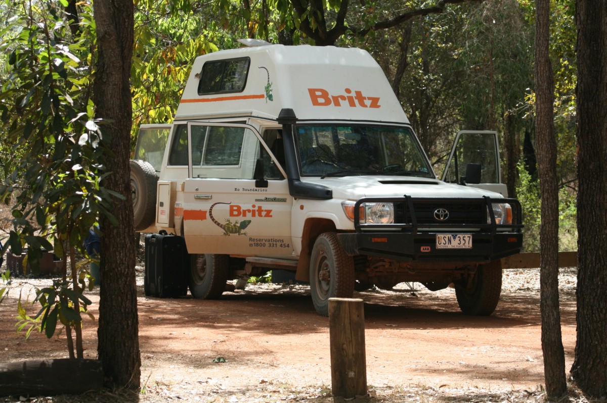
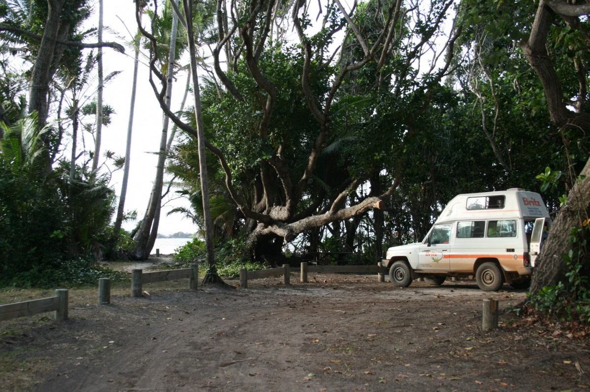
Next we booked our accommodation on wheels — the Britz Bushcamper, a popular model in the dry season. These 4WD Toyota converted campervans are not cheap – the cost for 17 days with total insurance cover (no excess), safety kit, chairs, table, linen, sleeping bags, pillows and awning was AUD 4,522 (NZD 5,625, USD 3,831, GBP 2,632)
Day 1
We picked up ‘Betty’ (the Bushcamper) just 4kms north of Cairns on 25th July, arriving on the doorstep of the rental yard at 7.30am eager to get under way as we had to get acquainted with her idiosyncrasies (and there were a few), buy essential food for 17 days and still have plenty of time to enjoy the drive from Cairns to our starting point at Wonga beach.
To our shock, the van was still dirty from the last trip with a thin layer of red dust inside and out. Worse, the right-hand front tire wasn’t roadworthy – and we had 3,000kms to go. After some discussion we were finally on our way back to our hotel with two new front tires. After we’d packed her up, we noticed a couple taking photos of the van. The couple told us they had rented her for the previous two week and just returned her the previous evening – they also told us they had complained about the state of the tires after getting three punctures.
Once out of Cairns’ suburbs we drove on sealed roads through sugarcane country and along the breathtaking scenery of the northern beaches, heading north along the coast to towards the Daintree National Park and bypassing main towns. We needed to get to the campsite before dark to do some serious repacking and rearranging of gear and food before we hit the rough roads. We stayed at Pinnacle Village Holiday Camp at Wonga Beach. Tomorrow was a big day as we needed to be up at the crack of dawn for a sunrise boat trip on the Daintree River, 15kms away, and prepare ourselves for the notorious Bloomfield Track.
Day 2 Daintree River & the notorious Bloomfield Track


This was when it really started. – the long dusty red roads that we were to brave for the next 17 days! We hit the Bloomfield Track at 11am. Books and blogs described it as “exceedingly” or “hideously” steep, slippery and exceptionally winding. It is also tidal and cannot be crossed at high tide. The best advice recommended stopping at Mason’s store in Cape Tribulation, just a couple of kilometres from the start of the track, to check the state of the road and the tides.
We arrived there about 10.30am, anxiously seeking reassurance that we could drive this fearsome road. I would have been more than happy to go the long alternative route around to Cooktown at the first hint of concern from the shop owner but, alas, the very pleasant young man behind the counter could not help – he had been a Masons Store employee for only three days. Nothing for it but to grip the wheel, put Betty into 4WD and head off.
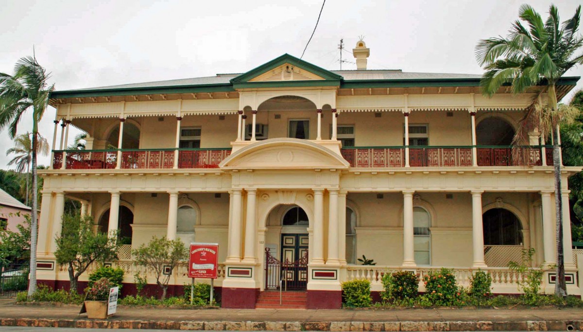
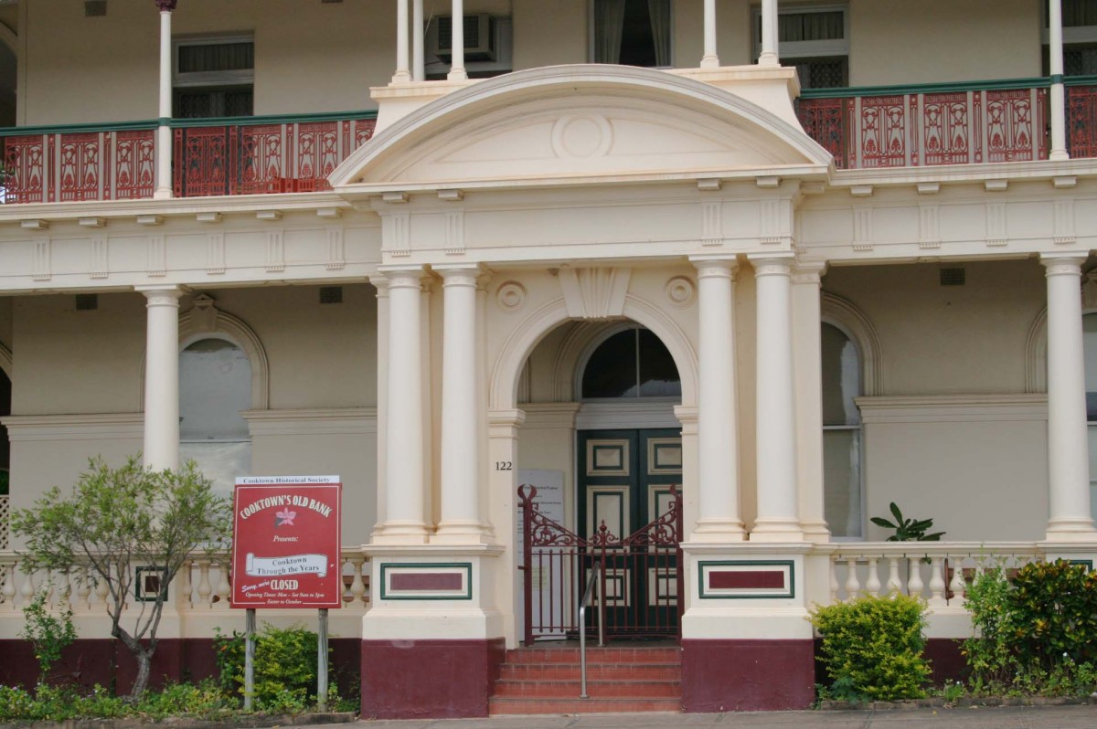
Two hours later, I felt a bit of a fool. We were eating lunch in the Lion’s Den 35kms south of Cooktown. I had built the Bloomfield Track up into a veritable Everest but it really was a piece of cake. Or maybe we were just lucky as there are many horror stories and it had not been raining. We were glad to reach Endeavor falls Campsite 31kms outside Cooktown after a leisurely wander around the town


Day 3 & 4 – Drive to Kalpowar Camp site in Lakefield NP – stayed 2 nights
However that still left the road from Cooktown to the tip of Cape York, which has has just about every 4WD challenge you could wish for, especially if you take the Overland Telegraph Line (OTL). Several of the crossings along this track are feared and revered. Bearing names such as Gunshot Creek, Nolan’s Brook (don’t be fooled by the gentle name), Cannibal Creek, Canal Creek or Logan Creek, they can leave you stranded or under water.
Fortunately, our insurance did not allow us to travel on the dreaded OTL, so we had no choice but to take the Southern and Northern bypass roads. We were, however, allowed to travel 8kms deep into the Elliott Falls along the OTL, provided we came out the same way. We heard many a tale of brave souls tackling Gunshot and knew of three vehicles that “drowned” during our trip.
The OTL started as a track through the dense forest of Cape York in 1885 and followed the path of the telegraph wires north, which was for many years the only means of communication between the residents of remote areas and Cooktown. The bypass roads –Southern and Northern — which begin at Bramwell Junction Roadhouse and end at the Jardine River, were developed later by Telecom Australia to service its newly installed telegraph wires. The first car ever to travel from Cooktown to the tip of Cape York was a 7HP baby Austin owned and driven by two intrepid New Zealanders in 1928. It took two months to travel the OTL which was then called the ‘goat’ track. They floated the car across the rivers including the crocodile infested Jardine River.
The Southern & Northern bypass road was most certainly not an easy ride. It was a long continuous red road with dips that could be shallow or deep, bone-jarring corrugations interspersed with large tracks of bull dust, a major road hazard which hides holes that can wreck your tyres or vehicle if hit at speed. Other common hazards are road kill and unannounced road works. At speeds of 20-40kms over corrugations, you feel as though you and the vehicle are being shaken to pieces. But at faster speeds of around 80kms, the corrugations are smoothed out somewhat.
Another hazard is the red dust thrown up by trucks ahead of us. Passing lanes are non existent so it was either put up with it and carry on or the more sensible option – stop for a cuppa. Of course Murphy’s Law dictates that as soon as you finish your cuppa and are ready to hit the road again, a truck passes and you find yourself eating the red dust again!
With our house on our back (well, Betty’s back) we could camp’ anywhere but this did not stop us setting out with a rough itinerary. Many books warned us of the need to book some of the more popular national parks well in advance. Also, an itinerary was a tool to keep family and friends happy. Our first remote camp site was in the Lakefield National Park where we had booked two nights at Kalpowar camp. The instructions were to drive to the Ranger’s Station, which we did, carefully following the signs. When we got there, there was nobody about and a sign read “strictly private”. It turned out that the “Ranger’s Station” is a large notice board where you write your name alongside a site and pay the fees into a box!


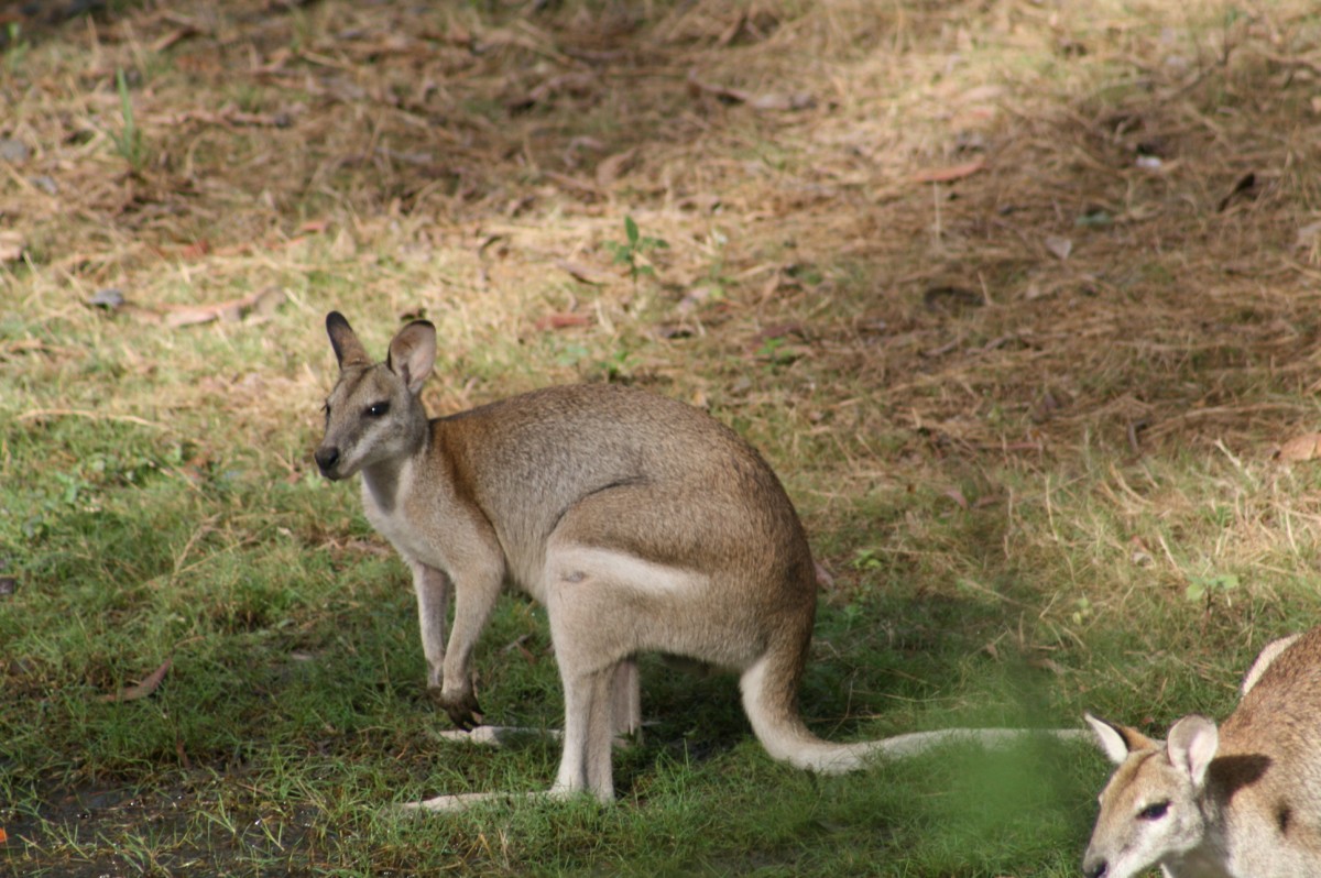


We chose a site from our map and it turned out to be inhabited by agile wallabies that crisscrossed the back of the site getting to and from their waterhole. We set ourselves up for two nights, cooked dinner, lit a campfire in a specially made iron base and enjoyed the night sky, the birdlife and a glass of wine by the light of the campfire.
At about 8pm our peace was shattered by the sound of several motorbikes arriving and we feared our little paradise was about to be spoiled. Instead our visitors quickly lit a fire, set up their individual tiny tents, ate their meal, donned head torches and moved around the site like mobile glow worms. They were in bed and asleep before us.
Day 4 Kalpowar Campgroud – Lakefield NP
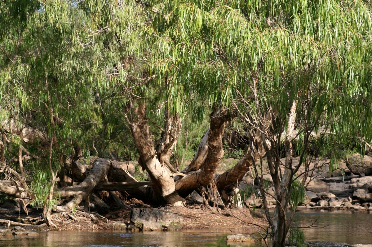
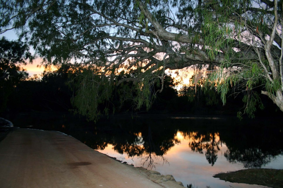
In the morning we took a walk down to the Normandy River running alongside the camp. There were several warning signs about recent sightings of crocodiles and the dangers of swimming or even getting close to the water’s edge. The date of the last sighting was a month earlier. The shores of the river were overflowing with birdlife – ibis, goshawk, pied herons, kingfishers and grey herons, to name but a few. On the other side of the camp were walking tracks and the ranger (a real live one this time) suggested a 4.5 km loop track that took us through flowering kapok trees and a variety of gum trees and fern trees.

We had completed about three quarters of loop walk when we disturbed a very large goanna tucking into his lunch. He seemed displeased by the disturbance and immediately retreated a few centimetres, leaving his meal, a black snake, in the grass between him and us. We decided to retreat behind some trees and wait, hoping he would grab his meal and leave. But this was his territory and he wasn’t moving. As we approached him again he rose up on his back legs, looking ferocious. I knew enough about goannas to recognize this as an attacking stance, so after some discussion we decided to circumnavigate our four-footed friend by taking a path through the bush and back to the campsite.
Day 5 From Lakefield NP to Archer’s Roadside
The road out from Kalpowar was red and rough. We stopped briefly at the white and red lily lagoons to admire the lotus flowers and birdlife, once jamming on the brakes when we came across two brolgas dancing in the bush by the road side, beautiful elegant birds famous for their courtship displays. We watched and photographed the pair until they danced off into the long grass and out of sight.

As we drove the Nifold Plains, we suddenly came across termite mounds standing everywhere, large ones and small ones. These amazing structures can be as high as 30 feet and take elaborate shapes. They face north-south, which helps them maintain a cool temperature even in the hottest of climates. Who needs a compass when you are surrounded by anthills that show the way, all created by insects no bigger than a pinhead.
Up here, fuel is like gold dust and at the Musgrave Roadhouse one has to wait for an attendant to fill the tank as pumps are kept locked. The attendant, a 12-year veteran of Musgrave, has been pumping fuel and lived in the area all his life. Fascinated by two grey-haired sheilas driving a 4WD truck, he spent a long time questioning us about our plans. Where were headed, where had we come from?
The road from Musgrave to the town of Coen, our next port of call, was easy and straight. Coen is reportedly famous for its fruit bats and we were keen to check them out, but after driving around the town three times we gave up and enquired at the local store. The owner looked at me like I was bats. “Fruit bats in Coen – haven’t a clue lady, didn’t know we had any!” So much for hearsay.
Instead we went to visit the museum which was surprisingly informative about the local history and displayed many artefacts from people who had farmed the area over the past century or so. But there was still nothing about fruit bats. After having lunch by the banks of the Coen river, we headed for our next stopover, Archer River Roadhouse.
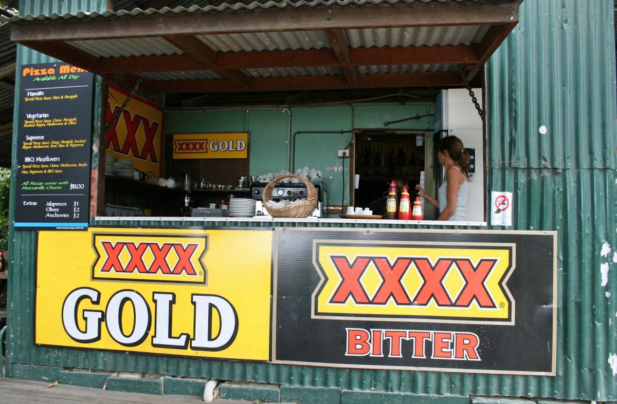
The roadhouse of the far north is a species all its own. The proprietors are pleasant and friendly and the locals are keen to share their considerable knowledge of the area with anyone who asks. Intended for one-night stopovers, the roadhouses let people park cheek by jowl. The generators make more noise than the crows and cockatoos. The cafés have plastic chairs and tables and the aroma of fast food mixes with the smell of diesel. Noisy 4WD cars, trucks and the huge road trains come and go until late into the night. For some unaccountable reason most drivers run their engines for a quarter hour before leaving.
Their vehicle parked and camp set up, new arrivals wander along to the café for a cold beer or (rather expensive) wine or to strike up a conversation with a fellow traveller, to use the local phone, or to take on the challenge of the famous Archer burger. The latter comes with a knife and fork because it is so full of food it is impossible to get your mouth round it. At every one of the roadhouses where we stayed, we saw local aboriginal families eating and drinking at the café, sometimes appearing to drink more than they should.
Marcia and I were becoming savvy about finding the ‘ideal’ camp site, learning to assess levels, views, proximity to toilet (not too close), neighbours and privacy. We often moved when people just drove up, and parked directly opposite so we ended up looking at the whites of their eyes instead of enjoying the trees and the birds. However sometimes close proximity to one’s neighbours cannot be avoided so friendly conversation would ensue. One night at Archer River road house, a retired couple in their mid fifties from Perth in Western Australia was spending one year travelling around the whole of Australia. They told us they had left Perth just after Christmas and the plan was to arrive back there to meet up with their kids next Christmas. They had been ‘on the trail’, as they put it, for months and [were really] enjoying it. In fact, they seemed quite addicted. British by birth but Australian in spirit, they never booked a camp site and, if they could not get into a site, they just camped by the nearest river. By astonishing coincidence, we ended up bumping into them several times during our trip, which was great for us who knew nobody.
We did meet many “grey nomads”, older people who had sold up their residence, purchased the complete home on wheels which often included a Winnebago-style trailer with boat on top and a 4WD vehicle towed behind, plus camping gear for every possible eventuality.
Day 6 To Chilli Beach
Next morning we were up with sunrise and off to one of the highlights of the trip – Chilli Beach in the Iron Range National Park where the wind blows constantly. The weather had been a little iffy over previous days so we had some concerns about staying right on the beach, but decided that if we got there early enough we could spend some time on the beach and withdraw to a more sheltered camp site if the wind [strengthened too much.] We made Chilli Beach in 2 1/2 hours as the road was in excellent condition – we must have been along the road soon after the graders. It rained all the way there and as we passed Mount Tozer it was shrouded in mist. We drove on through the lush, wet rain forest.

As we forded the Pascoe river, we stopped to talk to a couple who were heading in the opposite direction. They suggested we go to the site at the northern end of Chilli beach because it was less windy there. The sun greeted us on our arrival and we found the perfect spot, parked up and went straight to the ‘ranger’ board’ to register, stopping behind the ranger’s truck to complete the camp park permit. We put money in the envelope, dropped it into the honesty box and returned to our well chosen site, completely private and only 10 seconds from the beach. Brush turkeys, often mistakenly called bush turkeys, played in the scrub. As we watched, they combined for an assault on newly fallen coconut, pecking away until they broke into it. The meal lasted for hours.


As soon as we had set up our camp for the night, we strolled a few steps onto the beach, which appeared to be deserted as far as the eye could see although we knew there were others there as we had seen a few 4WD’s investigate our site. All the sites were virtual mini-sanctuaries, hidden behind swaying palms right beside the beach. Anybody stopping there needed to be completely self-sufficient in the absence of a local pub or shop. In fact, there was nothing there but the elements. The beach was long, with white sand littered with rubbish washed up from passing ships. One managed to overlook the flotsam and jetsam and admire the spectacular beauty of the east coast of Cape York. No swimming was allowed because crocodiles had been spotted, although we had not seen one of the predators and soon began to seriously doubt all those signs warning of ‘recent crocodile sightings’. We fell asleep to the sound of the wind whipping through the palms and the sea pounding the shore.
Day 7 – To the Iron Ranges National Park
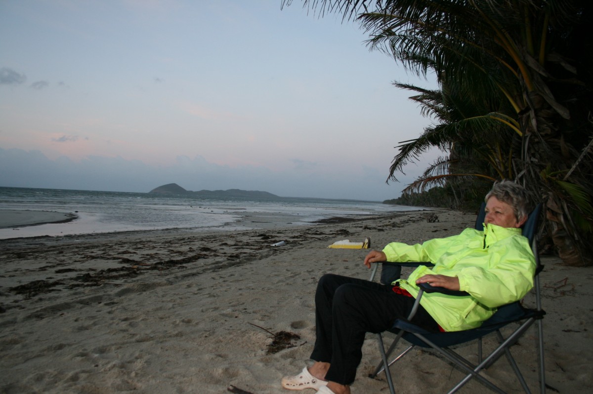
We awoke just before sunrise and took our chairs onto the beach to enjoy the first signs of the new day.

Your ads will be inserted here by
Easy Plugin for AdSense.
Please go to the plugin admin page to
Paste your ad code OR
Suppress this ad slot.
Reluctantly we left Chilli Beach early the following morning to head inland to the Rainforest camp site for the night, a fairly remote and isolated camp site still in the Iron Range National Park. On the way we decided to take a detour to visit Portland Roads and noticed a flash blue sign with white lettering announcing “Out of the Blue” café. Was this a joke in such a remote area? A café in the middle of nowhere? Deciding to investigate, Portland Roads turned out to be a beautiful little village and harbour, boasting a total population of 12. Even better, there really was a café and we ended up sitting on its deck and eating a huge plate of prawns washed down by some freshly brewed coffee. We had indeed found our oasis in the middle of the red dirt.

This haven in the heart of the outback was owned by a young couple, the husband having been a commercial fisherman in the area for many years who had sold his license to buy the café. The business was flourishing despite opening only between 9am and 2pm every day. The menu featured six assorted seafood and fish dishes with the fine print joking that the “information comes free”. The couple talked about the need to plan their menu very carefully as they only get two deliveries a week. Growing their own vegetables was out of the question because of the foraging brush turkeys. They had persisted for several years but the turkeys just flew over a six-foot fence and feasted on the produce.
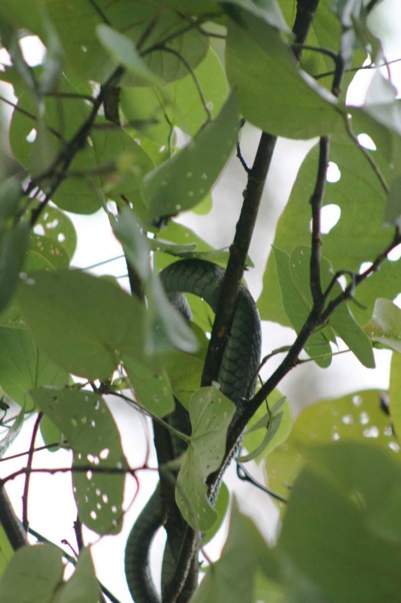
Our Rainforest camp site that night was remote and silent, still in the Iron Range. Our only neighbours, a German family who had been camped there for three days, were 750 meters away. They told us that they had spotted a green python just beside the site we had chosen. While part of me was excited at the presence of a big snake, the other and bigger part imagined a large reptile slithering over the top of the van as we slept.
We went early to bed and lay listening to an amazing cacophony of rainforest sounds before falling asleep, but not for long. We were rudely awoken around 9pm by our neighbours stomping around with torches and looking for nightlife.
Day 8 Seeing the Eclectus Parrot – amazing!
Our plan for the today was to walk along old Coen road but were faced with a dilemma – cross a stream with a sign saying “Beware of Crocodiles” or drive to the other entrance several kilometres away. We took the second option and decided to do the walk the following day. We woke to a dawn chorus which continued throughout breakfast. Then off we drove to the alternative entrance to old Coen Road where our nocturnal visitors had guaranteed we would find Eclectus parrots nesting in a very old tree. And they were right. We were lucky enough to see two parrots displaying their bold colours of red, green and blue. We watched, captivated, for about 10 minutes before they flew off, extending their spectacularly coloured wings……………….

Next stop Bramwell Junction Roadhouse to fill up Betty’s tank. Diesel got more expensive as we headed north [where most people working at the road houses and resorts seemed to be in temporary employment for the dry season, like the young English woman at the petrol pumps at Bramwell who had been there since June. Her partner was also employed for the season as the odd-jobs man around the roadhouse. They had come straight from England but planned to travel around Australia at the end of the dry season. However the owners were putting pressure on them to stay till the end of the season, the end of September.
We were making good time and thought we might head for Elliot Falls where we could have a swim safe from crocodiles. Elliot Falls in the Heathlands Reserve was 6.6 kms down the Overland Telegraph Line but this was the only part of the OTL, as it’s known locally, that Britz allowed their vehicles to use provided they returned by the same route. What an oasis in the outback it turned out to be! We arrived at about 3 pm and already it was getting crowded but we found a suitable camp site, donned our swimming togs and headed for the falls. We swam for about an hour and it turned out to be our first and last swim for the whole trip. We made the most of it, swimming under the falls, around the falls, walking on top of the falls and then back underneath the falls.
Day 9 Crossing the most expensive stretch of water in the world?
Next stop was the car ferry across the Jardine River. We arrived there about midday and paid $88 for our return trip. The ferry that carried us across the 400-500 meter wide river was propelled by a large steel cable and manoeuvred by a man sitting in a tiny control tower decorated by local aboriginal artists.

We drove on to Bagma, one of the bigger towns north of the ‘Jardine’, arriving there in Bagma at 1pm when everything was closed except the supermarket and the BP station. As we strolled around the supermarket stocking up on food, we met and chatted to several people we had encountered along the track. The BP garage turned out to be run by a Maori from New Zealand and his son, both enthusiasts of the town and area.
Moving on closer to the edge of Australia, we headed towards Punsand Bay resort to stay for the next four nights. The road was rough, full of potholes and ruts but worth it when we arrived at our beach front site on the edge of a long white sandy beach stretching as far as the eye could see. We were now as far north of Australia as one could go without actually standing at the very tip, just an hour’s drive distant. We found an excellent site, set up camp, had a hot shower, and went off for a cold beer, wine and a steak sandwich in the camp restaurant. A thirty- something couple walking past us in the camping area stopped to engage us in conversation – “you girls (he was on a winner here) are doing great travelling around the Cape all by yourselves – whaddya reckon – there should be more of it. I am going to tell my mother about you two”. We set up camp at Punsand Bay ready for the adventure to the ‘TIP’ tomorrow
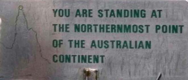
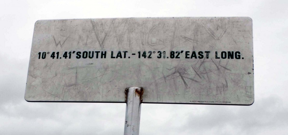
Day 10 – Finally we reach the ‘tip’ of Australia
The plan was to head off very early in the morning to reach the tip before the hordes turned up. Many people fly into places like Weipa and Seisia from Cairns to visit the ‘tip’, taking the easy route. So, bright and early Monday morning, we drove about 11 kms through the famous Lockerbie Scrub rainforest to the car park beside the track leading to the tip. We were the first to arrive there and took the Punja track. Thereafter we scrambled over rocks for about the next 20 minutes. Each rock face we climbed we thought might be our last before the tip but there always seemed to be another one. We had little or no indication that we were on the right track except for some very faint pale white track indicators as we negotiated rocks, more rocks and boulders. Finally we saw an insignificant sign in the distance and headed straight for it. It was a strange feeling to stand beside such a modest identification of the very edge of the enormous continent of Australia. Yet were felt exhilarated that we had made it all the way, exactly 403 years after the first European sightings of Cape York by Dutch navigator Abel Janszoon Tasman.

After leaving the “Tip” we drove to the failed trading post of Somerset, a small settlement that was established in 1864 by the first Government appointed resident, John Jardine. A natural entrepreneur, Jardine recognized the need for supply of fresh meat and started the first cattle station five kilometres kms beyond Somerset at Vallack with 2000 head of cattle. We visited the crumbling remains of the Jardine home at Somerset and strolled around what was once a bustling town, a hive of activity, with ships moored in the harbour and mainly Chinese divers seeking pearls on the seabed of the coast leading into the Torres Straits – it was known as the “Singapore” of the Pacific.


Today, all that remains are some old gun barrels, a few exotic trees and plants that once grew in the beautiful gardens of the Jardine homestead and some old graves with headstones written in the language of the pearl divers. We tried to drive beyond Somerset but met a couple in a 4WD who had to turn back as the roads were impassable due to rain. So instead we headed back through the Lockerbie scrub and went for a stroll along the Roma track for half an hour. Back at Punsand Bay, we treated ourselves to dinner in the restaurant yet again, as an award for reaching the “Tip”, downed a bottle of wine from the limited wine list, a lovely sauvignon blanc from New Zealand.
The one disadvantage about all campsites (except those very remote sites) is that one cannot close a door when the neighbours are less than desirable. That night, expecting to find the site as quiet and empty as we had left it, we were confronted by four extremely large people in the site next door, one woman and three men. The woman sat in a chair and was waited on all evening, the men moving very slowly. The youngest of the three men set his bed roll on his camp bed stretcher right alongside our campervan – no tent or awning – and went to sleep at about two in the morning leaving a dozen empty ‘tinnies’ on the beach. His laboured breathing and snoring made sleep almost impossible. 

Whenever possible, we built and lit a camp fire and became very efficient at it. There is something magical about sitting around a blaze listening to the world around you, reminiscing about the day just gone and planning for the day ahead. We had planned five days at Punsand Bay as we had hoped to take a trip to Thursday Island – “TI” to the locals — but there were not enough people in the campsite wanting to go so we missed out. That helped us to decide to head off a day earlier and spend an extra night near Laura, which would give us plenty of time to visit the many aboriginal art galleries in the area.
Day 12: Bramwell Junction Homestead here we come
As we drove out, the diggers were coming in to smooth the road – just our luck to miss a smooth ride! We stopped briefly in Bamaga to refill water, petrol and food and rang Bramwell Station to book for tonight – all guide books recommended this because of it popularity as the most northerly privately-owned working station in Cape York. We headed back down the northern bypass road, remembering to take the bright red roads this time which were in passable condition, but again we had great difficulty identifying which was the right road. On one side there was one bright smooth red road and on the other a grey rough road running alongside it. Which to take? There were no signposts. After a short discussion we chose the smooth red road because it looked so inviting.
A few kilometres later, we spotted a truck with a person under the wheel and asked him if we were going in the right direction. “Yep,” he yelled and went back to his wheel. We drove on 600 metres and came to a screeching halt in front of a huge mound of red sand shifted there by a bulldozer. We turned back and asked the our guide again. “Yep”, that was the way to Bramwell.
We did another U-turn but something about this mountain of red dirt looked wrong. Luckily another driver passed us and stopped when we asked for directions. Yes, we were on the right road but had to take the little grey gravel road off to the left! Eventually, we caught up with the smooth red road when we suddenly came upon two trucks blocking the road ahead. One truck was feeding the other truck diesel and between them they appeared to completely block the road. The drivers, both young men, beckoned us to come on and squeeze between the tree-lined ditch and the truck. As we gingerly approached, they leaped into action and ripped out the trees, allowing us to pass through with the barest of margins. Soon afterwards the lovely smooth red road turned into one of the worst roads we had encountered so far with steep corrugations on the straight road followed by tight corners with banks of white loose sand . It seemed to go on for ever.
Finally we arrived at Bramwell Roadhouse where we filled up with fuel before heading off for Bramwell Station. We crossed the cattle stop to find a real working station with cattle everywhere. A friendly chap called ‘Bluey’ came out from an open air bar and restaurant, slap bang in the middle of the grounds in front of the old homestead, to give us a warm greeting and direct us to a camp site shared with several graves belonging to the former owners of the property. Lining one side of the property was some very basic accommodation called ‘dongos’ — a bed, a chair and a window. What more could a man want?


Bluey was very talkative, asking us where we had been and telling us excitedly that only the second-ever aeroplane mail drop was happening at 3pm that very afternoon and we could come and watch. He then showed us several photos of the inaugural mail drop last week and the local celebrations to mark the occasion. Close to three o’clock we grabbed our cameras and walked to the air strip. We waited and waited but the plane did not arrive so we walked back to the camp site. One hour later he raced over on a quad bike and said: “Hop on, it’s coming”. Off I went, hanging on for dear life as he drove like a maniac over the rough terrain. People came rushing from all over the station to see the plane arrive. It landed two minutes later and unloaded the mail and other goods.
When it was time to leave, the pilot was unable to restart the engines for take-off. He jumped out with a very red face and spent several minutes deeply engrossed in an open side panel. After a few minutes he hammered it, closed it and hopped back inside. The engine burst into action and the aircraft disappeared down the runway.
We fell asleep under a beautiful clear sky full of stars and woke up to the most amazing moonset in the big morning sky, lighting up a giant termite mount close by. We stood for ages watching it until the sun rose and it lost it red hue.
Day 14 Bramwell Station west to Weipa
After a big breakfast fry-up, we headed for Weipa on the west coast. We drove through the Batavia Downs road, passing nobody but the local wildlife along the road. We checked into Weipa’s only camp ground, which even at noon was pretty full but we just managed to get a beautiful site right beside the beach with a view across the Gulf of Carpentaria.


Weipa is a busy town and most of its population work at the big Rio Tinto Bauxite mines that run 24 hours a day, seven days a week – even on Christmas day. At night you can hear the drone of the machines working at the mine even though it is many kilometres away. The locals put up with the noise and inconvenience as the company bring money, employment and good roads into the local economy. The company burn the scrub and excavate the land but they replant all areas after they have finished mining. What damage they do to plant and animal and sea life was not discussed – best left for locals to discuss among themselves. One got the distinct feeling the subject was taboo. We ate our meal, drinking wine and watching a spectacular sunset as several giant black-necked Jabiru storks strolled through its rays.
Day 15: On to Laura
Next morning, we set off early to our planned stop at Hann Crossing but we made such good time we ended driving as far as Laura – a distance of 496 kilometres, a dead end spot but a very convenient launch pad for the Quinkan art sites and the Quinkan & Regional Cultural Centre. We set up in the local camp grounds behind the rebuilt Quinkan Hotel that had been burned to the ground some years earlier. The locals were very friendly and keen for a chat about where we had been. We met two Frenchmen who were walking from the top of Cape York to the bottom of New South Wales, averaging 30kms a day. With a backpack each, they carried the rest of their gear strapped between two planks on wheels. They had no idea, they said, how long it would take them to cover the continent from top to bottom but thought probably about six months. They had flown into Weipa and got a lift to the top. During the first few days they realised they had brought far too much stuff with them, but they could not afford to pack it all up and post the parcel home to France as they were on a tight budget so the left the parcel on the side of the road with a sign on it reading: “Please use our gear as you need but if you see us along the way maybe you might give us food or drink”. Three days later a 4WD truck and trailer pulled up along side them and told them they had picked up their parcel but had no intention of using it. Instead they would take it home to New South Wales and the two guys could come and stay with them and pick it up themselves. They also gave them food and water! When we met them they had been walking for one month and they were having their first day off the next day and were about to have their first shower in three weeks.
Hardly had settled into our very basic camp site in Laura when we were invaded by a family of wallabies – several mothers and babies bold as brass checking us out. The young one were very brave and moved towards but very quickly the mums barked at them and brought them back into line behind them. The stayed around and grazed on the long grass on the verge of the camp. Soon afterwards the campsite suddenly began to fill up with travellers going north and south. A young German couple we had met several times on the trip spotted us in the campsite and pulled up asking if they could share our spot. We were only too happy to have them next door as they were good company. They had acquired an extra passenger – Steve, an English guy who casually told us he had cycled from Cairns to the “Tip”! He even carried his bike across the rocks and boulders so that he and his bike could be photographed together there at the final destination. A school teacher, he wanted to show his pupils back home that he had achieved his goal. The German couple Annette and Jorg had driven all the way from Germany to Cairns on a motor bike, but had hired a 4WD to travel from cairns to the Tip


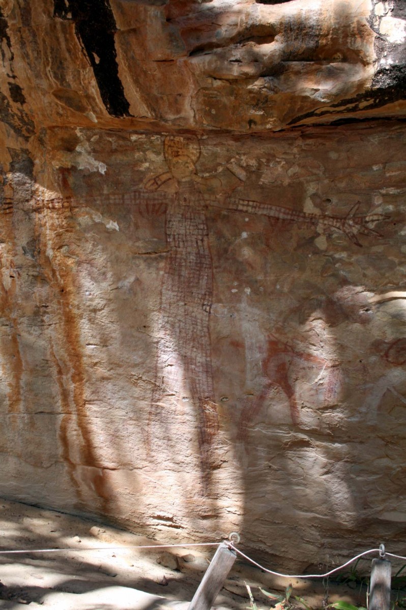


Day 16 – The Quinkan Art Site and on to Mareeba
The Quinkan Art site was our next stop but we very nearly missed it as we were so excited to be on tar seal for the first time in several weeks that we powered along so fast we overshot. There are no large signs for directions; you just have to keep a keen lookout. An honesty box had been set up for donations but it looked like it was anything but an honesty box as it had obviously been broken into several times, so we left our money at the art centre instead. In spite of the heath and hard going, we walked around the [outdoors] centre for two and a half hours, loving the variety of rock art along the way and the views.
We did not meet another soul on the walk but this was probably because we had gone through an area that said ‘no access’. However, the night before Annette and Jorg had told us that the person at the cultural centre had told them to do this. – there was no obvious reason for the no access sign but one did have to keep a look out for the markers as several were very faint. Sometimes we had to split and one would go ahead until the next marker was spotted and call back.
We decided to try to drive as far as possible that day after we had finished the walk as we had booked ourselves into an eco-tent at the Jabiru Safari Lodge, a treat for our last night on the road with Betty. We also wanted to get there early so that we could spend the day in the Mareeba wetlands where the Jabiru Lodge was situated. We drove as far as the Mareeba township and stayed in a very busy camp site.
Day 17: ‘Glamping’ at Jabiru Safari Lodge, Mareeba Wetlands
Next morning we arrived at the Mareeba wetlands at 9am just as they opened up. What a magic place! It was populated with many species of birds both inside large aviaries and outside on the lake, in the wetlands, the bush, the river, the trees, beside the tents and along the walkways. We saw pelicans, brolgas, pigmy geese, swans, Australian darter, pied shags and were able to view Gouldian finches through glass as the Mareeba wetlands were part of an Australian wide breeding programme with the aim to increase numbers throughout the continent. They release about 100 birds each year in November and get great feedback from local amateur ornithologists or “birders”.


Mareeba wetlands extend over 500 acres of savannas and wetlands, providing a sanctuary for some of Australia’s unique flora and fauna. It is a community conservation project combining run by the not-for-profit Wildlife Conservancy of Tropical Queensland with the help of volunteers. The money from tourism is reinvested into the upkeep of the wetlands and conservation programmes such as the re-introduction of the Gouldian finch. When we there, some ‘birders’ spotted mature and juvenile birds, a great boost to the programme as it meant they were breeding.
Right in the middle of this Savannah stood three eco-tents, our accommodation for the night. When the tourists left that evening there was nobody else except us and the animals and birds. We had ordered a gourmet BBQ meal which was sitting in a cooler beside the BBQ on arrival. After a 5kms walk around the lake, we sat in the still of the night eating our steak and salad and sipping bubbly. Bliss. In the early hours of the morning I was woken by a rustling sound outside. I got up quietly, grabbed my torch and peered outside – straight into the large round eyes of a quoll who was feasting the BBQ leftovers. Quolls are small carnivorous marsupials with a pointed snout and a long tail. The fur is reddish to dark brown to black and it is distinctively spotted with white. They are lively, attractive animals with a pink nose and sharp teeth and live in the savannas of northern Australia. I ran to grab my camera but he was gone by the time I got back.
Day 18: Last day with betty and back to Cairns
Early the following morning we took a tour on the lake where a local guide showed us the wildlife as we drifted through the red lotus lilies with their huge shiny waxen green leaves. The boat, which belonged to the Mareeba Wetlands, had been specially for use on the lake. It has no backwash so the birds, flora and fauna are not endangered in any way.
Sadly it was then time to hop into Betty for the last time and drive one and half hours to Cairns via a carwash so we could rid her of 17 days of that ‘bloody red dust’. We had enjoyed Betty for three whole weeks but now it was time to say goodbye and spend five whole days by a beach where it was safe to swim and in a hotel room that wasn’t on wheels.
A truly memorable trip.
