

Your ads will be inserted here by
Easy Plugin for AdSense.
Please go to the plugin admin page to
Paste your ad code OR
Suppress this ad slot.
Another year another bike challenge in New Zealand

This year the choice was the Remutaka (Rimutaka) Rail Trail. After months of research, bookings and reading blogs about the ride – eleven hearty souls set off from Auckland on different days and stages to meet up at the Top 10 Holiday park Petone on Sunday 3rd March 2019

It is a long drive from Auckland to Petone so several members opted for an overnight break at various places. Our little group of three, Marcia, Chris and I, decided we would stay in Taihape – why I have no idea but it seemed as good as any place to stop. We booked in at the Aspen Court motel who were very customer focused and prior to our visit sent us a ‘how to find us’ and ‘what to see’ in Taihape. The motel was comfortable, clean and suitable to our needs. It was also an easy walk to the town – 10 minutes. We had a lovely meal at the “Le Cafe Telephonique” near the centre of town.
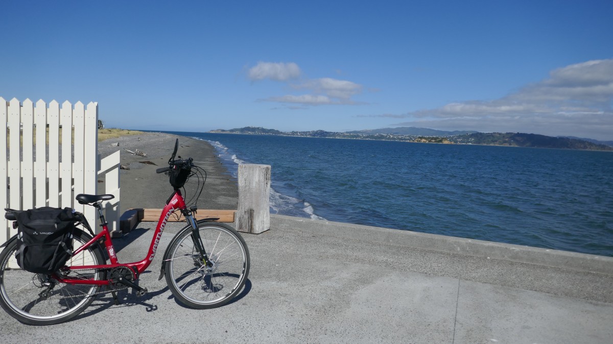
On the way to Petone the following day we stopped for lunch at “The Long Beach cafe” in Waikanae and then on to Petone to catch up with Dave from “Everyone’s Adventure” who was taking care of our bag transfers and our shuttle requirements. Two of our team were hiring E-bikes from his company. In our group of eleven, five people were riding E-bikes and the rest ordinary mountain/hybrid bikes. Dave was also going to advise us as to which way we would ride the Petone to Orongorongo beach via Pencarrow – it was very much wind dependant, and he would shuttle us and our bikes either to Orongorongo beach to start from there or pick us up after our ride from there.
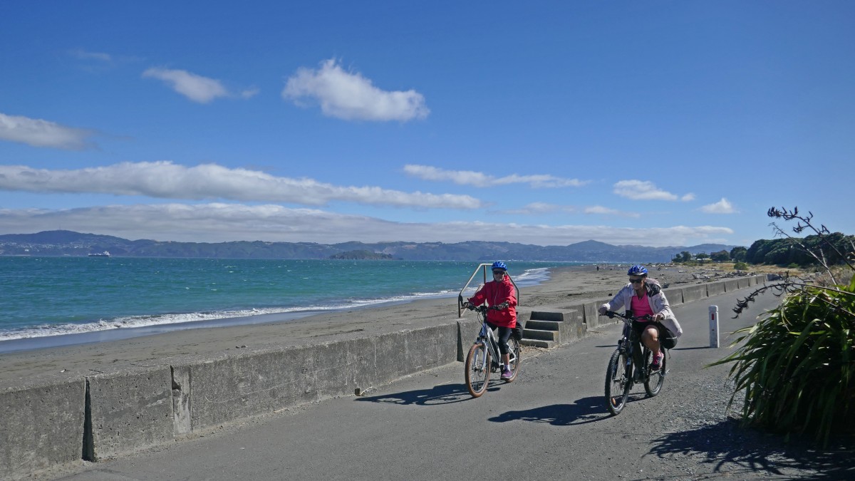
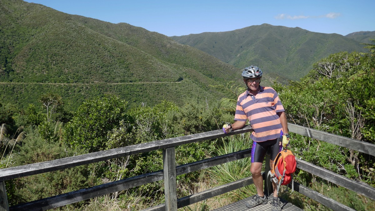
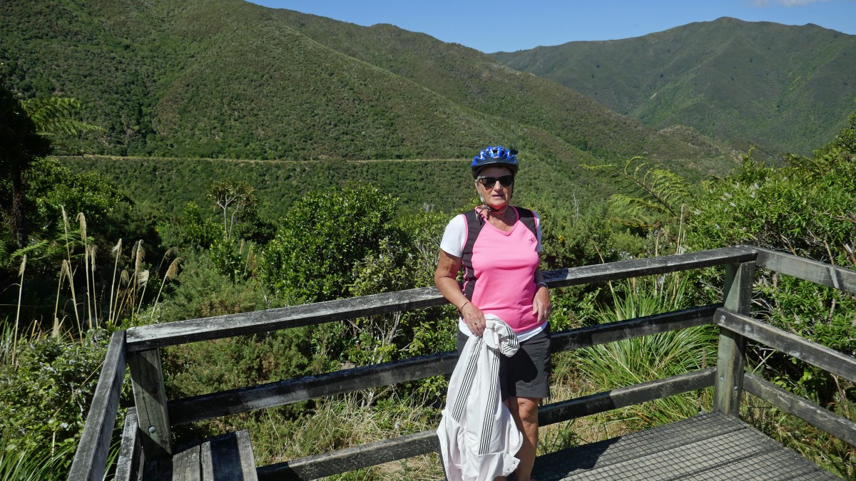
Day ONE – 33.5 + 5kms: Petone Top 10 Holiday Park to Orongorongo Beach carpark plus an extra 5km return ride to Turakirae Scientific Reserve and the seal colony.

We woke to a beautiful sunny day in Petone – everyone was out early fiddling with their bikes ensuring tyres were pumped, saddles were the right height, batteries charged and plenty of food and drink tucked away in pannier bags.
Dave from Everyone’s Adventure, arrived at 9am with E-bikes and maps. He suggested we should ride from Petone to Orongorongo beach as the wind would be behind us and he would pick us up from Orongorongo Beach at 16:30.
He took Chris & Helen, who had hired the e-bike, though their paces and took us through the cycle route telling us to keep the sea on our right and stay as close to it as possible. He also suggested we have coffee before we get to “The Bike Shed” beyond Eastbourne as that is the last place on this route for food and drink.
Armed with our maps eleven riders set off from Petone Top 10 negotiating a very busy roundabout and turning into Waione St to the Hutt River bridge where we joined the Hutt River cycle trail turning left towards Marine Drive. Safely across the roundabout and onto the bike path we relaxed. However, there were several areas where we had to ride along the busy roads and on footpaths before we got to Eastbourne where we stopped for coffee.


We passed Seaview, Point Howard, Sorrento Bay, Lowry Bay, York bay, Mahina Bay, Sunshine bay and Days bay with its boatshed and on to Eastbourne – 9.6km where we heeded the advice give and stopped for coffee.
Energised by coffee we headed towards Pencarrow stopping at the ‘Wahine Memorial’. This is a memorial represented by one of the restored masts from the Wahine – it’s foremast – and is situated on the beachfront south of Eastbourne. A plaque remembers the 51 people who died on the day, most of them died along the Eastbourne/Pencarrow coastline where we were riding – a somber thought.


Next we passed Dave working in ‘The Bike Shed’ on Muritai Road – one of the last bastions of civilisation before starting on the isolated part of the track.` This is where the beautiful scenery started, the trail was isolated, scenic and safe – and we loved it, what a way to go.
We rode through what was the old Burdan’s gate (where one once had to lift the bike over) but now has a ‘bike squeeze barrier’ built in 2018 which makes life easier especially for us E-bikers with our heavy bikes. We were now riding on the gravel road which was very smooth and easy to ride on and also very flat!
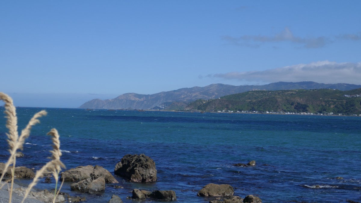
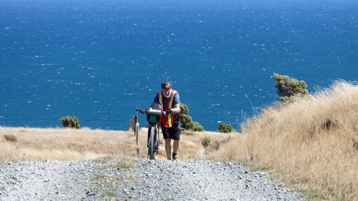
The coastline, on our right, was wild and very exposed which is why you need to have the wind behind you to enjoy the ride. We met some cyclists coming the other way and they were all rugged up and looked very weary fighting the wind all the way. The coastline is infamous for fierce southerly storms that whips the surf onto the coastline and the huge swells from the Cook Strait which can push boats/ferries onto the rocks.
About 2km along the Pencarrow coast road, east of Lake Kohangatera, the remains of the small steamer “Paiaka” lies beside the road. The ship was wrecked on 9th July 1906. The SS Paiaka was built 1881 and sank in Fitzroy Bay between Pencarrow and Baring Heads, just outside of Wellington Harbour. It was salvaged in 1987 and brought ashore to its present position to become a memorial to commemorate the lives and ships lost along this coastline. Luckily there were only 2 people on the boat when it sank during a north/north-westerly hurricane but they survived.


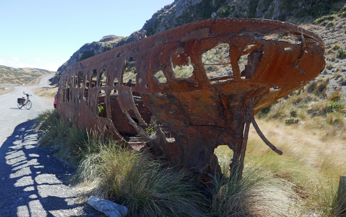
On this wild and rugged coast between Eastbourne and Baring Head there have been at least 40 shipwrecks recorded – most have disappeared. Having just passed the Wahine memorial and then the SS Paiaka it was a strong reminder of what a perilous harbour entrance Wellington has and how cruel the Barrett Reef can be, it was on this reef that the Wahine met its demise in April 1968. The sinking of this Lyttelton–Wellington ferry was New Zealand’s worst modern maritime disaster. 51 people died that day, another one a few weeks later and years later (1990’s) another victim succumbed to injuries sustained in the disaster.
We rode along happily enjoying the spectacular views across the harbour to Wellington city central which had a huge cruise ship berthed in the harbour, and we also enjoyed glimpses of the outline of the South Island across the Cook Strait. Of course such beauty along the route demands lots of photo stops including one where several mountain goats were happily eating the vegetation from the steep hills alongside the track.


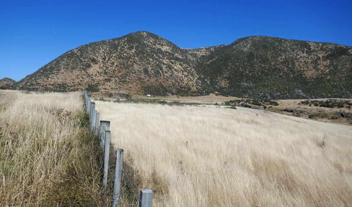
About 9km from Burdan’s gate we stopped at a steep track that leads up to the old Pencarrow lighthouse, and continues on to Lake Kohangapiripiri. There are two fresh water lakes – Lake Kohangatera & Kohangapiripiri collectively called the Pencarrow lakes and were created by an earthquake which separated them from the sea.
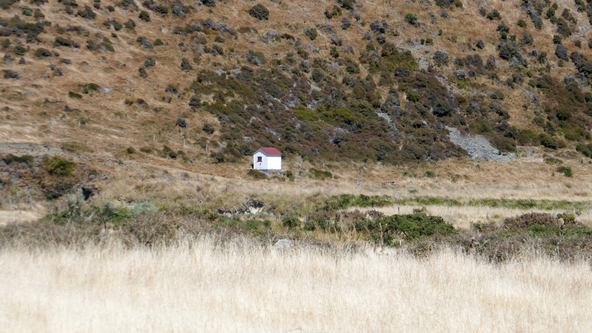
Because we did not know what was ahead on today’s ride we were reluctant to take the time to climb up to the lighthouse, however, two from the group climbed, on foot, up the steep slope to the top affording them a spectacular view. The rest of us cycled on to the lower lighthouse or second Pencarrow lighthouse at sea level. This lighthouse was built in 1906 because the old lighthouse on the hill was often shrouded in clouds!
A little history of the lighthouse from a Hutt Valley brochure:
“The iron lighthouse structure was cast in sections at Woodside Iron Works in the West Midlands. The 480 pieces were transported to New Zealand and assembled on site. The lamp was lit for the first time on New Year’s Day 1859 – making the record books as the first permanent lighthouse to be built in New Zealand. It beamed its cautionary message for 76 years until it was replaced by an automated light at Baring Head to the east. Pencarrow’s first keeper was Englishwoman Mary Jane Bennett, to this day New Zealand’s only woman lighthouse keeper. A widow, whose husband had drowned in the surf below, she and her children lived on this wild and isolated cliff top, tending the light, until 1865. The little daughter of a later keeper is buried here, her grave surrounded by a white picket fence”


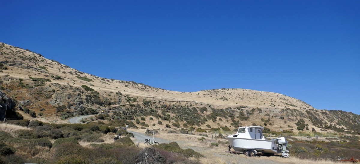
Our next hurdle was to identify an old white boat by the shore where the road divides. Straight ahead on a very rough road to the Bearing Head lighthouse. Dave told us we must turn left at this white boat so that we would end up at Orongorongo beach car park which was our meeting point for our transport home. We waited for all the group to arrive just in case someone did not see the white boat – which I must admit was hard to miss!! After a long slow steep climb up we stopped at the top to look back over the Cook Strait and of course – a photoshoot!


After struggling up the hill the views back over Cook Strait were amazing, time for a break and a photo shoot. Next we crossed some private land and made our way downhill all the way to the Wainuiomata river.


After riding across the bridge, however, our trail was blocked by a huge solid iron gate that was firmly bolted. Those of us with heavy e-bikes looked at the gate with horror – how could we possible lift them over this huge tall gate?
Luck was on our side as we spotted a Hutt Valley ranger working in East Harbour Regional Park a few hundred meters away and went and implored her to help us – did she have a key and could she unlock the gate please??? . She was most obliging and came with key in hand and within minutes the insurmountable large gate swung opened. She informed us that we were very lucky she had been there as the gate is always locked. She did say they were going to install a bike squeeze barrier in the near future but we were very disappointed that Dave had not warned us about the gate.
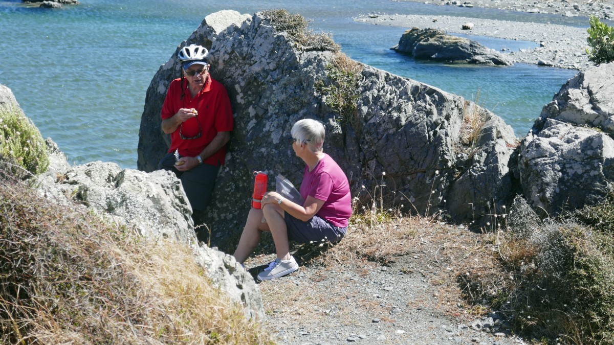
Safely through the gate and feeling totally indebted to the ranger we flew down the tar sealed road to the Orongorongo beach car park where we met the fierce wind howling in from the shore for the first time that day. We found some shelter behind rocks on the other side of the Orongorongo River where we sat watching some local fishermen catch their dinner while we had our lunch.
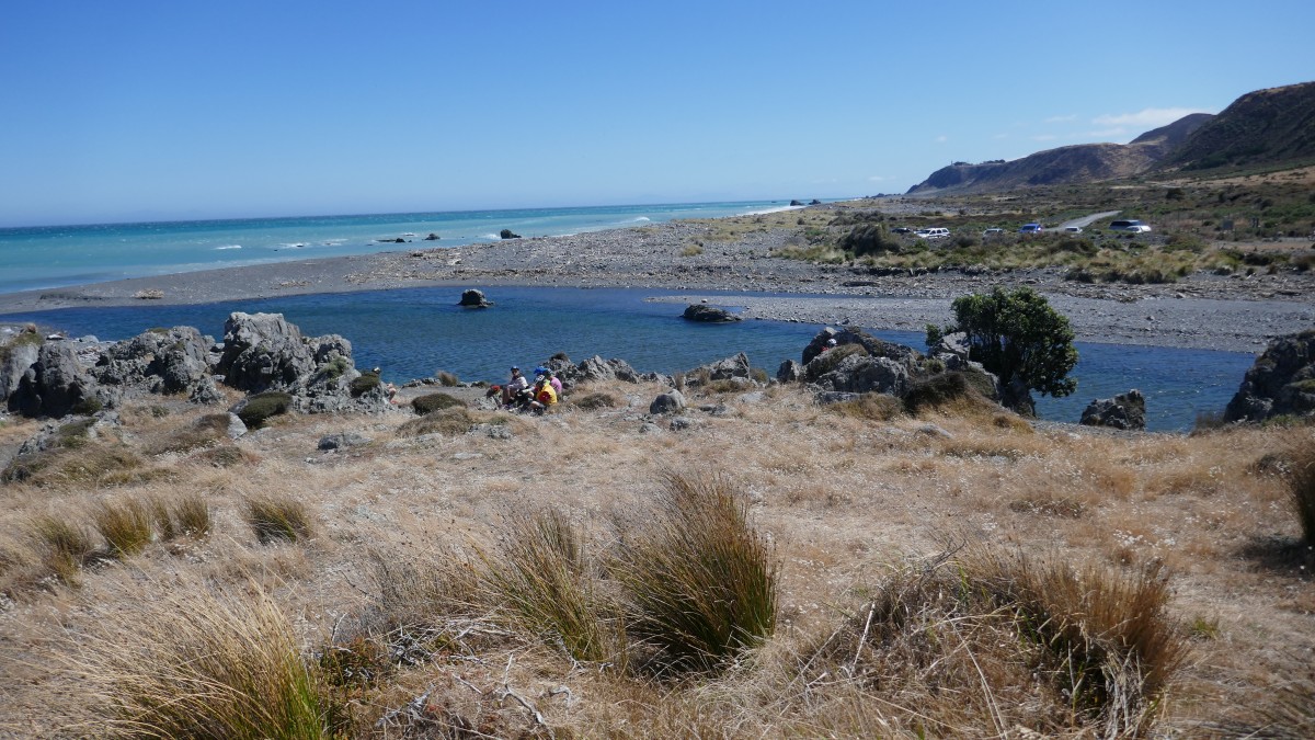


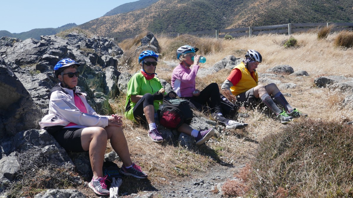

Dave had told us about the seal colony about 2.5km further on in the Turakirae Scientific Reserve. The majority of the group decided to ride to the seal colony and the rest opted to stay and snooze in the sun! The track to the seal colony was much rougher than we had experienced all day and we finally arrived at the reserve but soon realised we could not ride our bikes any further so headed off to the seal colony on shanks’ pony. It was a relatively short walk but seemed to take forever as we battled against the wind all the way. It made me grateful that we had not had to battle the wind the whole day on our bikes! When we arrived at the large rocky outcrop it was not very clear where the seals were so we all headed off in different directions. Finally with the aid of binoculars we spotted several fur seals on some off-shore rocks – they were not easy to see with the naked eye.
Dave and his van arrived at 16:30 to take us back to Top 10 in Petone. Wine, nibbles and beer was consumed and some pizzas ordered which were less than wonderful but we did not really care as we had a most fantastic bike ride and what scenery…..
Day 2: – 30km: Petone Top 10 holiday park to Kiwi Holiday Park near Harcourt Park, Upper Hutt

Today, we said good bye to our cars for three days. They were safely tucked away in the Top 10 ‘lock up’ costing $5 per day if you book ahead, $10 if you don’t book ahead. We also had to do a little repacking to comply with the required weight of 15kg per bag as the bags were being transported from place to place over next three days by Dave from ‘Everyone’s Adventure’.
After several false starts – where’s my bag?, where are my car keys? my pump? my torch? my lunch? my drink? – we were off. We left all bags in the foyer for Dave to collect – but there did seem to be a few more than eleven bags???

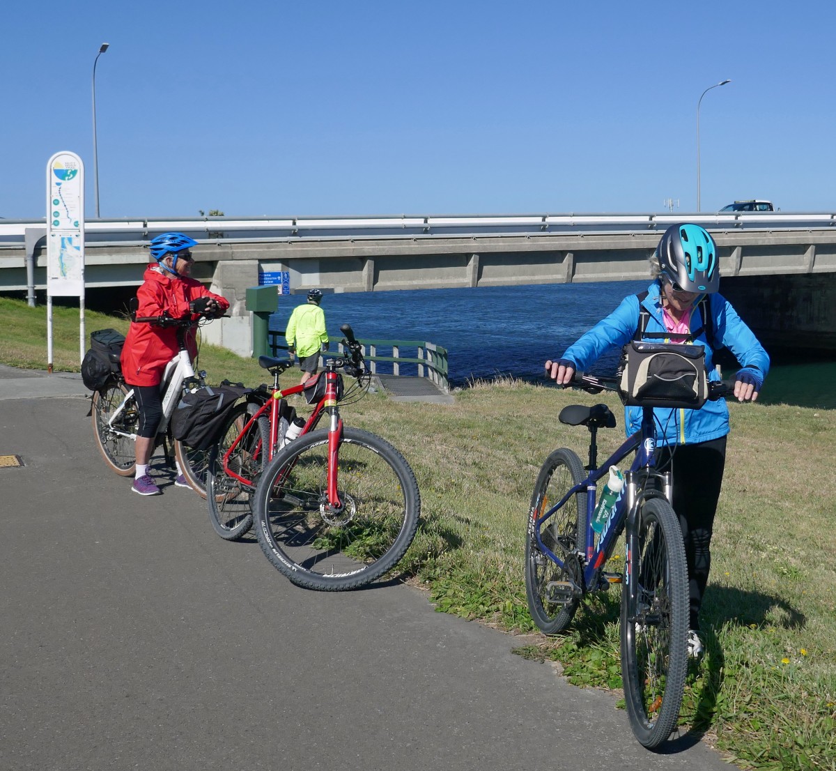
Another clear blue sky as we headed to the dreaded roundabout again but this time, instead of turning left at the bridge, as we did yesterday, we took the right turn onto the track under the road and headed along the Hutt River keeping it on our left!
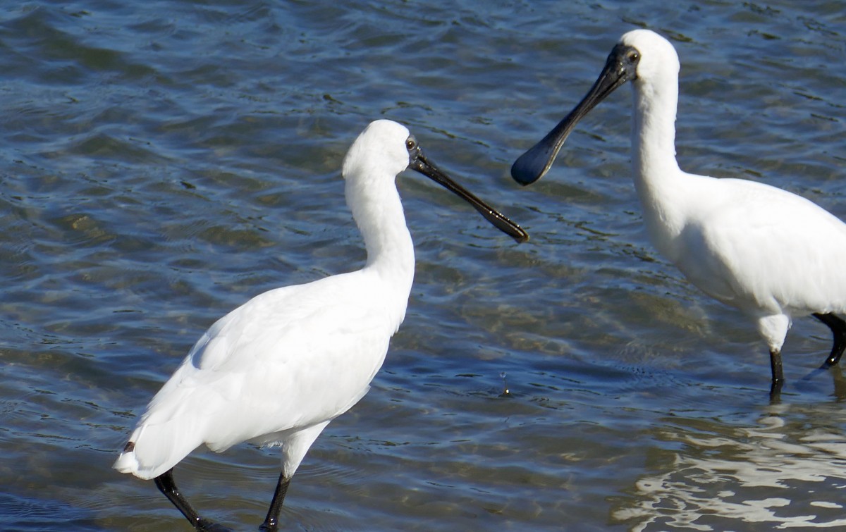
Two minutes after we started riding I spotted several Royal Spoonbills very close to shore – definitely a photo stop.


The path called the Hutt River Bike Trail was smooth and flat for a while and then suddenly there was heavy gravel and a steep uphill which took the early riders by surprise and we had our first ‘incident’ of the day when a rider was separated from his bike but thankfully it was not serious.

Keeping the Hutt river on our left we passed several busy industrial areas on our right riding through Strand Park, under Railway Ave road and past the Lower Hutt War Memorial Library arriving at Avalon Park where were were joined by another cyclist. ….a friend of Heather and Bob’s who lives in Wellington and came to join us for the day. By this time we were keen for coffee so stopped to ask a few locals where we could get a cuppa – ‘best place closest to the track was probably the Caltex station at Stokes Valley’! So on we went aiming for that destination – and they were right it was a good coffee!


The signposting was excellent along most of the track but we found it a little confusing when we reached Totara park Road where there were two signs for the Rimutaka Trail – one up and over the bridge and one straight on. I rode over the bridge to confirm that we needed to keep the Hutt river on our left until we reached Harcourt park and our home for the night – Wellington Kiwi Holiday Park (also known as Harcourt’s Holiday park). We sat on the banks of the Hutt river and ate our lunch while waiting for the group to catch up. There had been another wee incident with another rider who scratched his leg going through a cement stile but again all was well.
Having ascertained that we did need to keep the river on our left we rode the last few km to our destination. It seems that the Hutt River Trail and the Rimutaka become one from Totara Park Road up to Birchville which probably caused the confusion with the signposting. Once we arrived at Harcourt Park we asked direction to our accommodation from a local walker and were told to take the road – all very straight forward but we later discovered a better and shorter route through Harcourt’s Park!

Your ads will be inserted here by
Easy Plugin for AdSense.
Please go to the plugin admin page to
Paste your ad code OR
Suppress this ad slot.

It was a relatively easy day’s ride and we arrived at Kiwi Holiday Park at about 2pm. What a little oasis it turned out to be. Set in lush wooded area with bouts of magical birdcalls followed by silence. Our bags had all been safely delivered – our only issue was food as there was little available in the immediate area and we had no cars so most settled for fish and chips from the local which was pretty basic. We all loved this little friendly holiday park with all facilities you could possibly need. Had there been a nice little restaurant close by it would have been perfect!
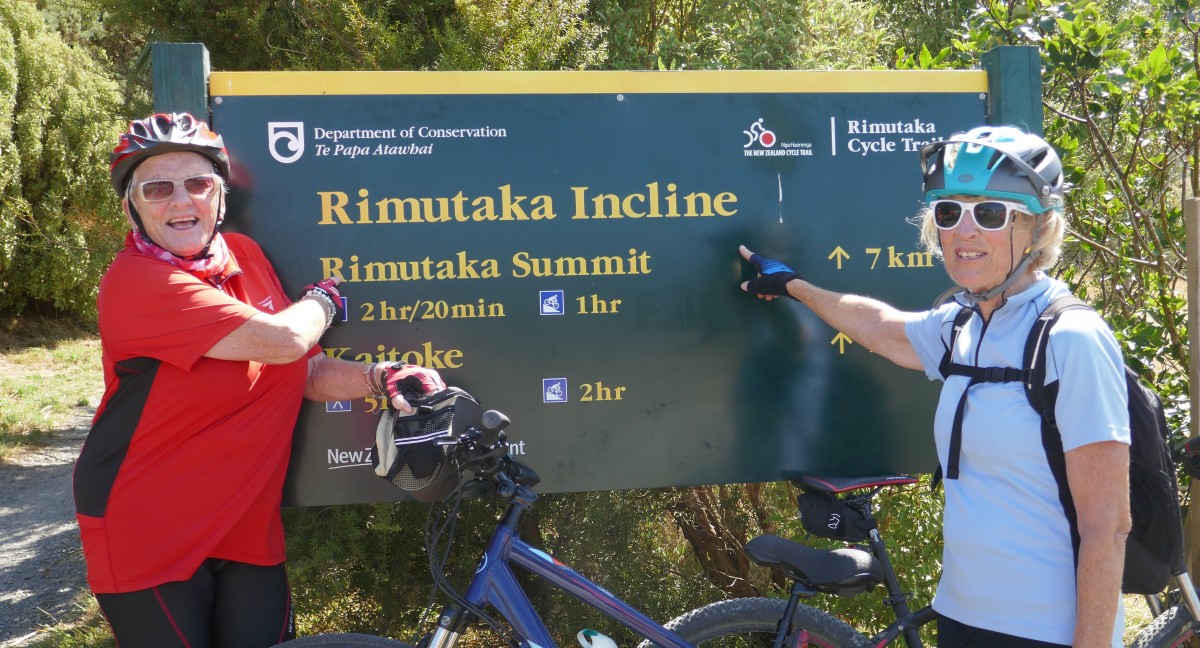
Day 3 – This was the big one! Kiwi Holiday park, Upper Hut to Waiorongomai Station through the Rimutaka Incline! – 48.8km, Grade 3-4

Another beautiful morning and we were all ready for off at 08:30. This was our BIG day! Everyone had plenty of food and drink for the day as there were no food sources on todays’ route!

We headed back into Harcourt park and followed the Rimutaka trail signs. We left the trail after about 3-4kms and rode on a quiet country road through Te Marua and along the Maymorn Road to Maymorn station which was a non event! We were past it before we realised what it was! We then headed through a gate and up a steep sharp incline for about 200 meters then we had a very steady uphill incline to the summit 19km away.
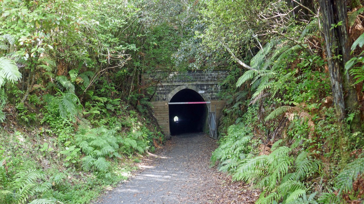
Our first tunnel was just about 500m beyond Maymorn – the Mangaroa tunnel 253m long built in 1877. We were all armed with torches but really did not need them for this one.


3-4 km later we turned right into Incline Road (a quiet sealed road) and followed the signs to the ‘pinch’ gates. We were quite close to Hwy 2 in parts of this road. We came to Kaitoke car park and were warned about a rifle range close by. There is also an information board and many more dotted all along this trail. We saw nor heard anything from the rifle range as we zoomed past it.
A few km along we came to Pakuratahi tunnel, 73m long and built in 1876. We could see the end of the tunnel before we entered the beginning!

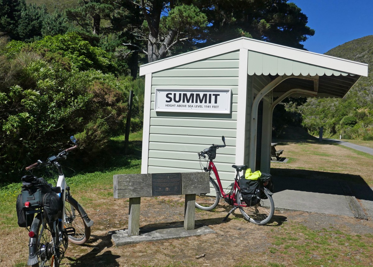
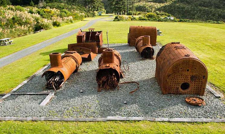
19km from Maymorn we arrived at the summit, the sun was shining but there was a keen wind. This was our agreed lunch spot and we enjoyed a half hour, eating drinking and chatting and reading all the information boards about the amazing incline railway gradient. This is a beautiful picnic area with lovely views and areas to walk around. There is a wooden shelter from the wind and some old rusty remnants from the old Fell locomotives that worked hard on the Incline for 77 years! There are also toilets here.


Refreshed and rested we headed down the incline – taking care as we rode through the gravel patches. Our first hurdle was the Summit tunnel built in 1877 and 584m long – we definitely needed our touch for this one! The gradient of 1:15 used for the Fell locomotives starts part way through the long 584m Summit tunnel, built in 1877.
We stopped at a look out just off the track on our way down. What a beautiful view – it looked way over the green forests and we also spotted our next tunnel amongst the greenery less than a km away. It was the Siberia tunnel built in 1878 and is 108m long.

Our biggest challenge of the day came after the Siberia tunnel when we approached Siberia gully which had once been a large sweeping embankment but was washed away in 1967. This left a very steep rough gravel & rock descent down to the stream and then a very steep ascent on the other side. For the E-bikers what lay ahead appeared to be a monstrous climb especially trying to push a 25kg bike up a nearly vertical slope filled with rocks and gravel. Thankfully everyone helped each other and we all made it safely to top. At one stage I was taking one step up and two back down and if I tried to use my throttle my bike reared up like a wild stallion!

Onwards and downwards to our next tunnel enjoying the views and the downhill as we rode. Tunnel 5 – Prices tunnel built in 1875/6 and is 98m long! A few km along we finally came to Cross Creek Station. which has a historic site where there once was and still has the remains of a locomotive depot and a turntable. Once this little area had a school, library and several homes.


This was not the end of the track, in fact the trail becomes quite narrow and undulating and we needed to focus on the trail as there were several slips along the track and not enough room for more than one bike but with relief we met nobody coming the other way and all arrived at Cross Creek carpark where we read on an information board that this was the end of our Incline adventure.


But we still had 16.4km to our accommodation at Waiorongomai Station so we turned right and rode along a main tar sealed road. We thoroughly enjoyed riding on the tar seal after so much gravel and revved up our e-bikes!! We rode alongside Lake Wairarapa for many kms. As we got close to Waiorongomai station we came to a beautiful little church on the left side of the road called All Saints Anglican Church which was built in 1927 by the descendants of Charles & Elizabeth Matthews who started farming Waiorongomai station in 1850. It was built as an ecumenical church to service everyone, but the running of it became too hard for the Matthews family so the Anglican church took over. The family however are still very involved and spend a lot of their time trying to keep the grounds and church up to scratch. It is clearly in need of TLC but the cost is prohibitive for both church and family.


We finally arrived at our very clearly marked destination. We had booked two cottages within the station which have been specially refurbished for bikers like ourselves who only stay one night. Our cottages were Burling & Ratanui cottage. Karla, our host came around to check that we had everything we needed and spent some time talking about their part of farm life as the sixth generation of the Matthews family.
The cottages were beautiful and were surrounded by fields full of sheep. There were kunekune pigs just along the way. We all agreed it was paradise. Everything we wanted was there in our cottages and we had arranged to have dinner there and breakfast so we all joined forces in the large cottage Ratanui. There was plenty of room for all 11 around the table so we chatted, drank wine and ate and chatted about the days’ events – mostly about our efforts to get up out from that ‘bloody’ Siberian gully!


Surrounded by the sound and smells of the Wairarapa and a beautiful sunset we all headed off to our rooms for a good nights sleep!
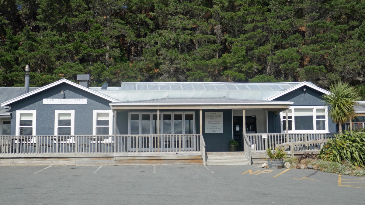
Day 4 – Waiorongomai Station to Lake Ferry Hotel – 37.4kms

We woke to cloudy skies – the first sign of rain since we started our trip. Karla informed us that the weather forecast indicated rain which would increase tomorrow. Based on the threatening clouds and the weather forecast we decided to head off after a hearty breakfast. Having taken our food scraps to the Kunekune pigs who showed absolutely no interest in them, we headed off to Lake Ferry.

It was pretty well sign posted except for the main junction where we met the Martinborough Road. So one of our groups waited to point everyone in the right direction and by this time it was drizzling steadily and phone service was ‘iffy’ so we could not rely on that for communication.


It was an easy pleasant ride (despite the light rain) but we had been warned that there was no cafe along todays’ route. So you can imagine our absolute delight when we saw a coffee banner waving in the wind about 7 km on the Martinborough side of Lake Ferry. What a lovely surprise and what a gem it turned out to be! Called ‘The Land Girls’, it had coffee, gifts, delicious food and lots of character – what more could we want? News spread along the group very quickly and suddenly everyone was gathered there to have coffee and sustenance in the tiny settlement of Pirinoa. If you could not get what you wanted in the cafe the the shop across the road sold just about everything.


The rain began to clear as we left the cafe and we were able to take in the beauty of the countryside. The sun came out as we got close to Lake Ferry which we were pleased about. We arrived there a little too early for check in but our bags had arrived and the staff were very helpful and happy for us to take our bags to our rooms which was a big bonus. This is a very old hotel so we all shared the ablution block which was clean with several showers and toilets. Our rooms were pretty sparse but we had a bed and a shed for our bikes and there was a pub for drinks and food! We had pre-booked our group for dinner at 6:30 pm- just in case they were busy.


The settlement of Lake Ferry is between the shores of Lake Onoke and Palliser bay. This is a very old region of NZ dating back to the 12th century! Farming started in 1844 and in 1850 a ferry service was established across Lake Onoke. The story goes that the ferryman needed extra income and so he opened Lake Ferry hotel in 1851.
After unpacking and sorting our bikes, the sky was blue and the wind was pretty strong, but we decided to brave the wind and go for a walk down to to the beach. We saw a few people fishing and also saw a vehicle stuck in the soft sand with lots of people trying to push it out. Alas, it was going no where and the local tractor was out on another job so the family (on holiday from Australia) had to wait for a tow-truck from Martinborough! They waited in the hotel enjoying some food and drink. I believe they finally got their vehicle out close to midnight!


After a few close encounters with some cockroaches in the shower we enjoyed some fantastic whitebait fritters and wine and had the hotel to ourselves after 9pm.
Day 5 – Lake Ferry Hotel to to the Claremont Motel, Martinborough – 35kms

The rain started during the night and did not ease during breakfast but we had to get 11 bikes and 11 people to Martinborough by 14:30 to get a lift back to Petone to collect our cars so there was nothing for it but to get on our bikes!! We ensured everyone knew the way – it was very straight forward but was also on a main road that could be a little busy so care was needed. We all set off at different stages and some chose to stop at the Land Girls cafe again for coffee but i decided I was wet and miserable so kept going. There was nothing for it but ‘head down and bum up and go’ on the e-bike. I was within a few kms from Martinborough when an ambulance with flashing lights passed and I thought to my self – I do hope that is not for one of us……… but when Marcia caught up to me she told me it was indeed for one of us. Chris had come off her electric bike and hurt her shoulder. She was taken by ambulance to Masterton where they discovered she had fractured her humerus. Poor Chris – what an end to her biking holiday. While the rest of us went wine tasting in Martinborough she was in a collar & cuff sling and taking painkillers! Not an ideal way to end a holiday.
Martinborough – 3 days!


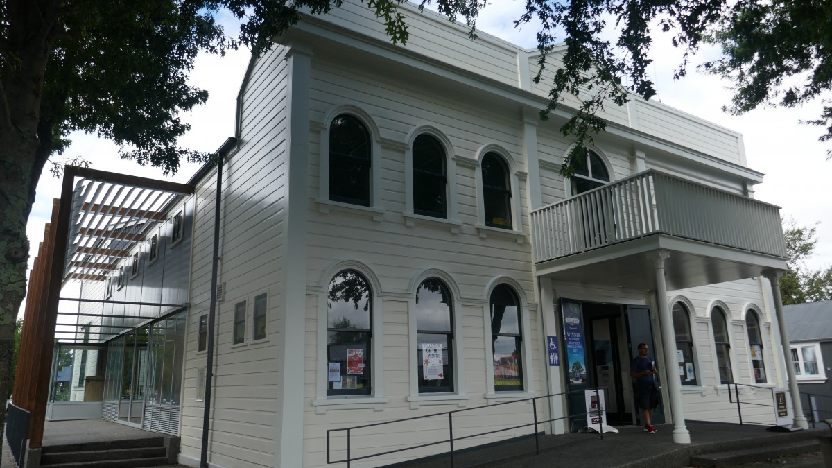
We had three nights in Martinborough, visiting the vey pretty Greytown in the heart of the Wairarapa, which was a great hit with everyone. In 2017 it won New Zealand’s most beautiful small town award!

On our second to last night we ended with a dinner at Pinocchio Restaurant, Martinborough – great food and wonderful ambience. When we arrived we discovered we were sitting outside and it was a chilly evening and we did not come dressed for outside dining! But we were supplied with warm blankets which cause lots of laughter and fun!


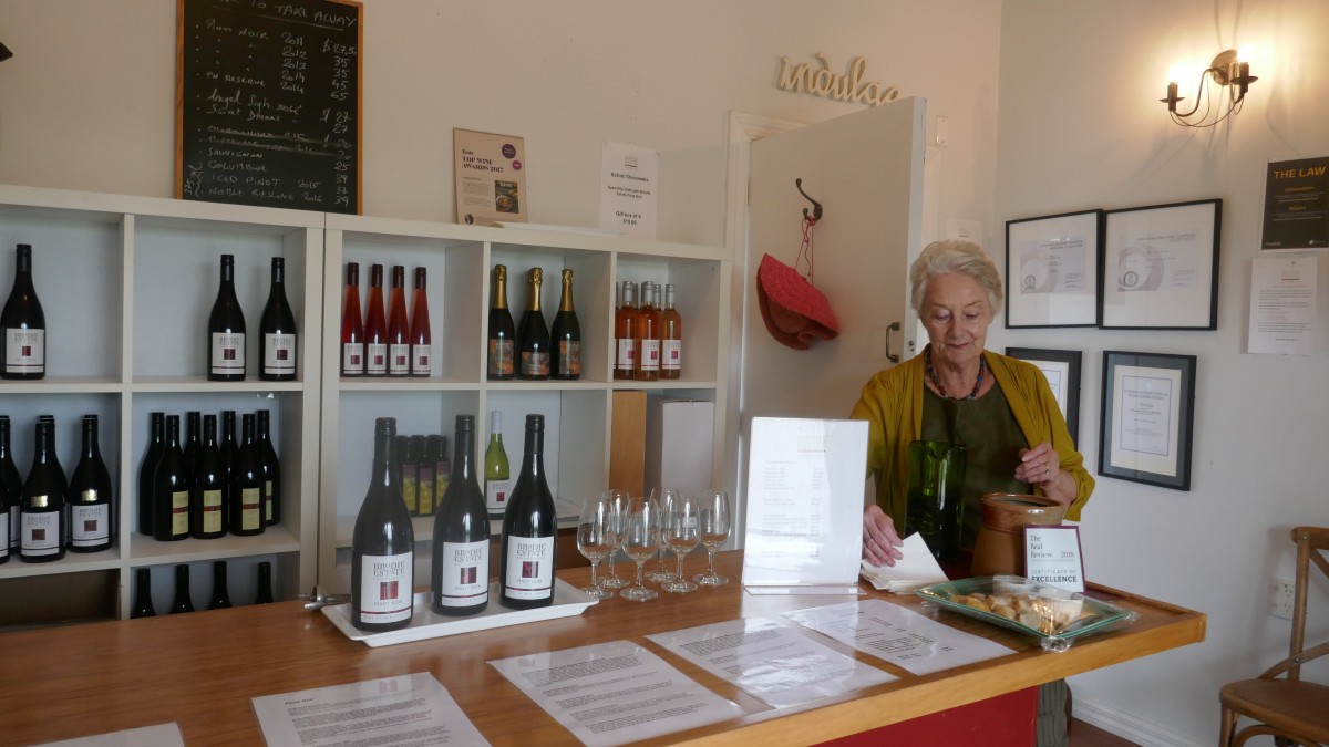
On the last day we went wine tasting at “On Giant’s Shoulders” & “Brodie Estate” and enjoyed both very much. On Giant’s Shoulders is a very old vineyard with a young owner just setting up for wine tasting and can only do it privately until he gets a licence. Brodie’s Estate has a new owner and the Brodie wine is still been sold until it runs out!

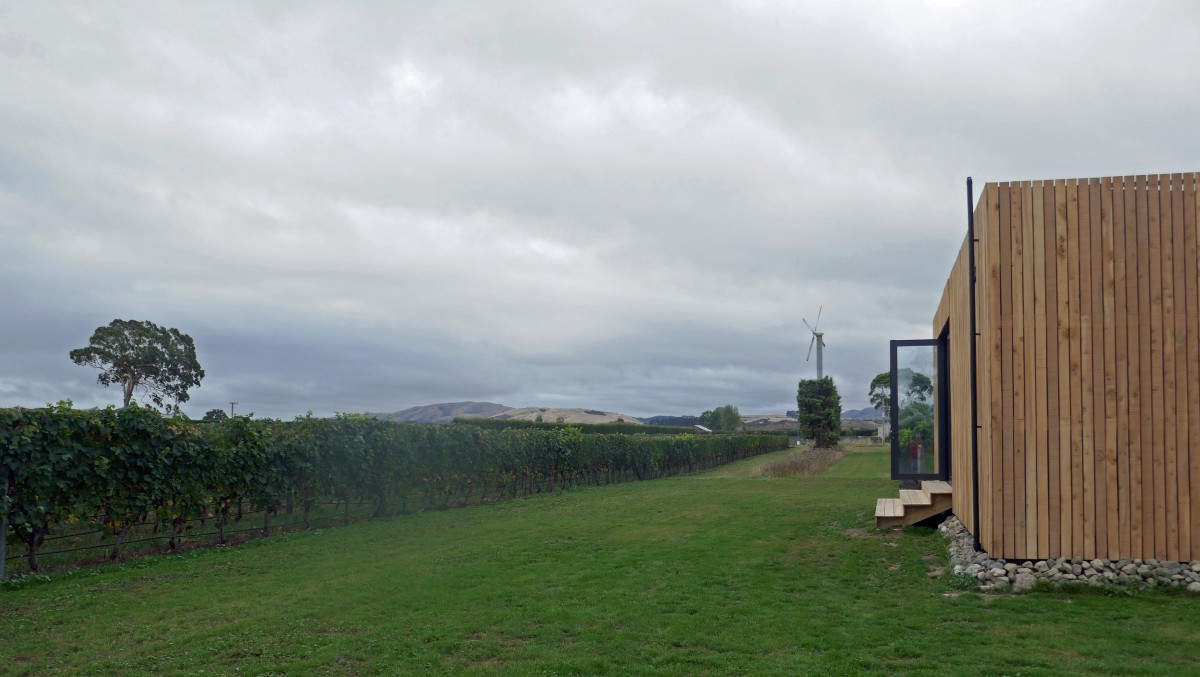
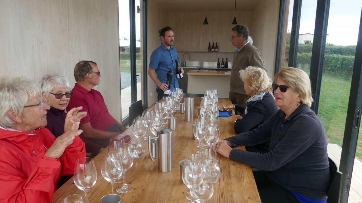
We then cycled to Brodie’s Estate


Despite Chris’s accident everyone loved the bike ride and of course the beautiful countryside – a glorious part of New Zealand.